|
DAILY NEWS ONLINE |
|
|
|
OTHER EDITIONS |
|
|
|
|
|
|
|
|
|
OTHER LINKS |
|
|
|
|
|
|
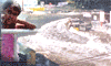  |
Atlas on the buildings affected by the tsunami - 2004SRI LANKA is one of the countries which was affected badly by the tsunami - 2004. Of the 14 districts located along the coastal belt, 13 districts were affected by this disaster. The Department of Census and Statistics played a leading role in providing information on the impact of the disaster. To provide reliable and accurate data, the Department of Census and Statistics, conducted a census in all the districts affected by the disaster. Damage to the housing units was reported from 663 Grama Niladhari Divisions. Altogether, about 89,000 housing units were either completely or partially damaged due to the disaster. The number of housing units either completely damaged or partially damaged to an unusable extent, is about 50,000. The highest number (8,139) of completely damaged housing units was reported from the Ampara district. This is followed by Batticaloa and Galle districts and the numbers of completely damaged housing units of these two districts were 7,445 and 4,482 respectively. The number of completely or partly damaged buildings other than housing units was 11,000. The highest number (3,170) of such buildings damaged was reported from the Galle district. Recently, the Department of Census and Statistics, released an Atlas presenting geographical variations of several key indicators on the impact, by tables, graphics and maps. In this Atlas, information is given at all administrative levels: District, Divisional Secretary Division and Grama Niladhari Division. The first copy of this Atlas was recently presented to W.J.S. Karunarathna, the Secretary to the President by A.G.W. Nanayakkara, Director General of the Department. Dr. Amara Satharasinghe, the author of the Atlas was also present on this occasion. Department of Census and Statistics |


|
|