Surveying over two centuries
Survey Department marks 210 years:
S M W Fernando Surveyor General
Natural earth resources are threefold; irrigational resources,
hydrographic resources and mineral resources. The common characteristic
of these resources is their limited supplies to the required demand. It
is a well known that it is hard to achieve the successful development of
land use activities for economic development without adopting necessary
land policies. The history of the Survey Department is the real
evolution of land policies.
|

Mapping and surveying, main functions. File photo |
The second department established by the British for the
accomplishment of land related activities including irrigation,
agriculture and meteorological forecasting was the Survey Department
after they ceded Sri Lanka’s coastal areas in 1796.
Europeans had restrictions on purchasing land holdings on absolute
ownership other than enjoying small land plots in Colombo and its
suburbs for residential purposes until 1810.
The restriction imposed thus was released in the same year 1810 and
in 1812, awarding Grants in Perpetuity to Europeans and their
descendants as were settled in Ceylon before its conquest was declared.
The quantity of land so granted was declared not more than 4,000 acres
to any individual. During this period, Survey Department had been
engaging on surveys for these massive grants. Following land ordinances
made statutory before Sri Lanka gained independence caused the Survey
Department to be engaged on various surveying functions in the country.
* State Lands Encroachments ordinance No.12 of 1840
* Definition of Boundaries ordinance No.1 of 1844
* Land Registration ordinance No.5 of 1877
* Waste Land ordinance No.1 of 1897
* Land Settlement ordinance No.20 of 1931
* Land Development ordinance No.19 of 1935
* State Lands ordinance No. 8 of 1947
Owing to sudden popularity of coffee plantation after 1840, land
sales escalated in unprecedented magnitudes and the Department was more
often engaged on State land surveys for the expansion of plantation
economy of the British.
Engineering surveys
Engineering Surveys were designed for the rehabilitation of ancient
irrigation schemes and for the development of areas under new human
settlement schemes such as Galoya, Padaviya, Minneriya and Udawalawe.
The department also completed Contour Surveys, Village Tank Surveys
and surveys to mark waterfalls and roadways with the initiative of
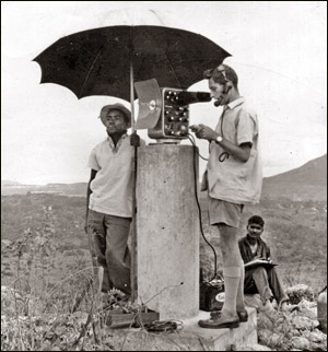
Reconnaissance
Survey Department
|
* Established
on August 2, 1800.
* The oldest Government Department in Sri Lanka
* Aimed at abolition of common land holdings and envisaged
individualization of land ownership
* First Surveyor General: J.Johnwil (1800)
* First Sri Lankan Surveyor General: N.S.Perera (1954)
|
Surveys at large scale. To fulfil these surveys, field officers had
to work more often than under hard and tough conditions in forestry
areas. Surveys required to prepare blocking out diagrams as the base for
creating human settlements and to set out and finally hand over
allotments to people. In the recent past, Survey Department under
irrigation schemes completed Engineering Surveys of Moragahakanda and
Umaoya Irrigation projects.
Demarcation Surveys
Demarcation Survey is a kind of surveys carried out with greater
emphasis to clearly distinguish between State lands and private lands
after independence. Village Plans under Block Surveys and Topographic
Preliminary Plans were prepared under Land Settlement Ordinance for the
Settlement Officer. On Settlement Officer’s order, Demarcation Surveys
were carried out to prepare Final Village Plans (FVPs) and Final
Topographic Preliminary Plans (FTPs) showing the settlements decided by
the Settlement Officer. FVPs and FTPs depict lands declared as State and
private. Under state lands they also depict lands developed under Land
Development Ordinance.
Sporadic Surveys
The Land acquisition Act No. 9 of 1950 provided provisions to acquire
lands for communal purposes. The Department had to receive and carry out
common surveys such as acquisition surveys, vesting surveys, village
expansion surveys and surveys for land alienation and land marking under
middle-class schemes to a larger extent at the request of Government
Agents and Land Commissioners.
Among the recent Sporadic Surveys carried out by the Department are
Deduru Oya, Ihala Kotmale Hydro-power station, Kataragama Railway line
and all expressways, alienation of 100,000 lands under The Mahinda
Chintana and handing over lands under Walawe Left Bank Irrigation
Project.
Major tasks engaged by the Survey Department under Sporadic Surveys
are declaration of areas, valuation, expansions and town surveys for
planning and reformation, and forest surveys covering a large area.
Survey Department has completed these surveys by employing a large
number of surveyors. It is evident that the Survey Department had been
engaged in abundance on Engineering Surveys, Block Surveys and Sporadic
Surveys in the first 20 years after independence.
Land Reform Surveys
Land reform is the determined change of land tenure, land ownership
and Land administration. At the time of independence, land tenure
pattern of Sri Lanka had been partial to the capitalist production
system.
At that time, most of the lands vested in State under Land
Encroachment Ordinance and Waste Land Ordinance had fallen into the
hands of local higher class and foreign investors.
A special landmark event of the Government under Sirimavo
Bandaranaike’s Premiership during 1970 - 1977 is the land reformation
activity of vesting about one million acres of land belonging to local
and foreign upper class through the implementation of Land Reform Act
No. 1 of 1972 on a Parliamentary constitutional reform.
|
Surveying the hill country lands. ANCL file photo |
It was necessary to employ two third of the departmental field staff
strength to survey about 15,000 statutory determinants containing about
300,000 acres at the Land Reform in 1972.
One of the commendable tasks accomplished by the Department is the
completion of a greater amount of this work within about six months.
The main responsible task of the Survey Department after completion
of surveys for land reformation was undertaking surveys pertaining to
expedited Mahaweli Development Project. It was necessitated to carry out
expeditious and special surveys for the construction of large reservoirs
such as Maduruoya, Moragahakanda, Kotmale, Victoria and Randenigala, and
for the development of an area of about 350,000 acres consisting of
large roads, waterfalls, towns and a network of residential units.
Among the surveys carried out to the satisfaction of foreign
consultants who performed the constructions, and foreign organizations
which provided grants are Contour Surveys, Dam Axis Surveys, Surveys for
Geological and Geophysical investigations, Acquisition Surveys, Tank
Boundary Surveys, Setting out Surveys, Waterfall Surveys, Town Surveys
and Blocking out Surveys.
A considerable number of departmental staff have been assigned to
work for the expedited Mahaweli Project since 1978. The Department by
now has been engaged on land marking surveys to issue grants for
alienated lands, surveys to finalize acquisition procedures and surveys
for reservoir peripheral development at the request of Mahaweli
Development Authority.
Cadastral Surveys
It is possible to bring convincing evidence from time immemorial that
the title to land had been defined with the use of various
methodologies. Such lands were divided into two categories; lands owned
by King and lands owned by civilians, could be claimed as Viharagam,
Dewalagam and Nindagam, and Paraweni as well.
Later, it was possible to distinguish between State lands and private
lands from the Waste Land Ordinance introduced in 1840 and it can be
identified as a major juncture of land ownership. From time immemorial,
various documents have been introduced to claim the land ownership,
where Copper Sannasa, lekam mitiya, rock inscriptions and Thombu during
the era of Kings had been used as title certificates to Lands during the
period of Dutch. During the period of British, titles as well as deed
registration had been adopted.
Attempts made in 1863 to issue title certificates to lands under
Title Registration Ordinance did not succeed. Subsequently, as a result
of new amendments made in 1877, Kirulapone, Wellawatta and Dehiwala
areas within the Colombo suburbs were declared as Special Registration
areas. Even nowadays a land transaction in such areas must be carried
out in accordance with title registration regulations, in which, a
certain registration of a land plot is required to refer to a survey
plan registered in the Surveyor General’s Office. Since the difficulties
encountered in implementing this system islandwide, in 1927, Document
Registration Ordinance, which is supposed to be covering every aspects
of document registration was imposed by improving Deed Registration
System introduced in 1864.
A necessity of a clear title to land arose because of the importance
of land for the development of the country. As a result, preparation of
cadastral maps was initiated in three selected Divisional Secretariats
in 1996 as a pilot project. Title Registration Act No.21 of 1998 was
passed as a legal provision to this effect.
As an initiative to title registration in Sri Lanka, Government
declared Divulapitiya, Balangoda and Uda Palatha Divisional Secretariats
as Cadastral areas on a Gazette notification. Until year 2002, these
Cadastral maps were prepared at the cost of Sri Lankan Government as a
national program. Thereafter, Cadastral maps were prepared with World
Bank funds under Land Titling Project from March 15, 2002 to June 30,
2007 thereby completing surveys of 58,547 land plots for registration of
title.
After diverse experience of 10 years from 1996, Bimsaviya program
identified as an activity to issue title certificates to lands in
compliance with land management and land use of the country has been in
progress as a national program since 2007 in 18 Divisional Secretariats.
So far, 217,750 land plots have been surveyed under this program. It is
expected to expand this program in 50 Divisional Secretariats by 2015.
One of another major tasks carried out successfully in parallel with
the Bimsaviya Program by the Department is systematical storage of
digital cadastral surveying data accumulating in volumes at the Surveyor
General’s Head Office in a spatial database management system to form a
comprehensive Land Information System (LIS) to the entire country.
It is expected to make this database web enabled in near future for
the use of land information required for various applications benefiting
not only Land Administrators, decision makers and organizations dealing
with land related information such as Valuation Department, Land
Registration Department, Land
|

A surveyor at work. File photo |
Settlement Department and the Land Use Planning Department but also
the public to obtain information as and when required for matters
related to land ownership and land transactions.
Geodetic Surveys
Horizontal control network commenced to establish in 1857 was
completed in 1933. As the technology is advanced over time, a network of
higher accuracy based on modern surveying techniques was highly felt. As
a result the old horizontal network was upgraded with the use of Global
Positioning Systems (GPS) with the advancement of Satellite technology,
establishing 294 primary control stations to cover the entire island. In
addition, establishment of about 10,000 control stations required for
giant development projects and road development projects has
successfully been completed based on the upgraded horizontal network.
Now initiatives are being taken to revise the existing Vertical
control network established in 1930, since most of its Benchmarks have
either been lost or shifted due to recent road development activities.
Further, a series of lectures have been conducted to Security Forces
to obtain accurate position of targets and geo-information using Global
Positioning Systems.
Topographical mapping
Necessity in finding out right knowledge on geographic location of
the country, shape and size of the country, location of important places
and their distances in between, roads and their lengths and information
of land use and evolution of earth, caused the introduction of
systematic mapping in the country.
Victorious efforts made by Surveyors and Draughtsmen to survey and
map every piece of topographic information of the country with the use
of surveying and mapping techniques provided the basis to produce
one-inch map series to cover up the entire country during the period
1897 - 1903.
An idea about the amount of information so surveyed is reflected by
the surveys of roads at a length of 14633 miles and channels, streams
and rivers at a length of 11836 miles. By 1925, there had been in
existence a complete topographic information cover of the entire country
in one inch sheet mapping.
Later, it was realized to replace the existing one inch map series
with a new topographical map series since one-inch sheets were compiled
way back in 1925 with more obsolete information representing at the time
of replacement. Another reason to update mapping process was the
necessity of internationally recognized metric maps required for
feasibility studies. Survey Department commenced a giant mapping project
called Agricultural Base Mapping Project (ABMP) for the production of
topographic maps of the scales of 1: 10,000 and 1: 50,000 in 1978 to
cover up the entire country. Capturing aerial photographs of the scale
of 1: 50,000 required for new mapping using photogrammetric techniques
to cover important areas was carried out during the period of 1980 -
1982.
These aerial photographs were used to produce topographical maps of
the scale of 1: 50,000. Compilation of 92 topographical maps of the
scale of 1: 50,000 to cover up the entire country have already been
completed. Also, It has already been completed compilation of 886
topographical of the scale of 1: 10,000 maps out of 1024 maps to cover
the entire country and the work of the rest is under way.
Aerial photographs of the scale of 1:20,000 were captured in order to
cover 70 percent of the area of the country during the period of 1990
-1994 and these photographs have been in use for mapping at the scale of
1: 10,000.
Mapping section of the department was upgraded with modern mapping
devices and the Process and Printing branches were strengthened by the
installation of a large process camera and a modern printing device. It
has already been completed preparation of topographical maps of the
scale of 1: 10,000 to cover Eastern region of the country with the use
of satellite images under a loan granted by French Government.
Capturing aerial photographs of the scale of 1: 20,000 with
Photogrammetric techniques to cover entire Northern region has been
commenced for the rapid development of the Northern Province under Japan
International Cooperation Agency (JICA) project, where expectation is to
map Jaffna and Mannar Districts at the scale of 1: 10,000. Also,
initiative steps have been taken to produce a new edition of
topographical map series of the scale of 1: 50,000 to cover up the
entire country with the use of satellite images.
Due to the turbulent conditions prevailing in the North and East
during the recent past, 1: 10,000 mapping in those areas had been
retarded. However, with the smooth conditions prevailing now in such
areas, topographical mapping series of 1: 10,000 for the entire country
would probably reach successful completion by the end of this year.
Remote Sensing Unit
Remote Sensing Unit of the Department was established in 1978 and
hence the ability to utilize Remote Sensing techniques for efficient
mapping became really feasible. District Land Use Maps of the scale of
100,000 have been prepared for each district with the aid of satellite
images and its processing techniques.
Remote Sensing Unit very recently completed preparation of Digital
Land Use Maps for areas under Southern development and it is possible to
provide such information in digital formats. Further, Survey Department
is proud to have gained rare opportunities to organize and launch Fourth
Asian Conference of Remote Sensing (ACRS) in 1983, 17th ACRS in 1996 and
the 29th ACRS in 2008 in Sri Lanka.
Thematic mapping
In consequence of having a greater demand for map users belonging to
a wider category for obtaining maps under especial themes, survey
department has compiled a number of thematic maps based on topographical
maps, in association with aerial photographs, satellite images and
statistical data obtained from the organizations concerned.
Sri Lanka Road Map, Sri Lanka Tourist Map, City of Colombo, Weather
Map, Relief Map and Map under the theme of the antiquities of
Anuradhapura era are among a few of the popular thematic maps produced
by the Survey Department.
National Map Atlas
One of the major functions of National Map Atlas is to convey a
strong impression to citizens of their identity, living in a particular
country. Survey Department, being the focal point to produce National
Map Atlas in 1988, paved the leadership for an expert committee
consisting of University Professors and officials of the relevant
ministries and departments.
The National Map Atlas published in English medium encompasses 59
multi-coloured maps and 55 technical articles including tracings
covering different fields. Planners, Decision Makers and Foreign
Expertise would realize National Map Atlas as a rich source of worthy
information.
In 1992, as a conciseness of the first edition of Sinhala and Tamil
School map series including nine themes and 40 articles for school
children was released.
The second volume of National Map Atlas was published in 2008 by
taking one step forward. Sinhala and Tamil translation of the second
volume including 80 valuable articles under 12 themes and 125 maps are
being processed these days. It would be a greater opportunity for school
children, university students including the public to study wider range
of facts and figures about Sri Lanka out of this volume subject to
translation, which is expected to be released in the near future. |


")


