Training for Lanka to improve maritime, hydrographic area
International Hydrographic Organisation chairman Admiral Mustafa
Iptes expressed commitment from the International Hydrographic office of
Monaco to provide funding and technical support and training to Sri
Lanka to further improve the maritime and hydrographic area.
|
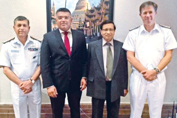
Dr Sayuru Samrasundara and M A Ariyawansa with Chief
Hydrographer of India Vice Admiral SK Jha and Admiral Tom
Karsten of the Royal Navy of the United Kingdom |
He congratulated Sri Lanka for developing rapidly in the region as an
important stake holder in the Indian Ocean region.
He made this comment at the 13th North Indian Ocean Hydrographic
Commission Meeting held in Myanmar from February 18 to 22 with the
participation of over 15 nations including Sri Lanka, America, England,
Australia, France, Russian Federation, Saudi Arabia, India and Pakistan.
The North Indian Ocean Hydrographic Commission is held yearly with
the participation of its member states to discuss and take action in all
issues concerning the Indian Ocean hydrography.
Hydrography is an area which is important for all nations to
understand and produce navigational routes and charts for all types of
maritime transportation. The National Hydrographic office (NHO) of Sri
Lanka, under the purview of the National Aquatic Resource and Research
Development Agency (NARA), is the main organisation responsible in all
hydrographic work in Sri Lankan waters.
NARA chairman Dr Sayuru Samarasundera and NHO hydrographer chief M A
Ariyawansa participated in this conference representing Sri Lanka.
The NHO was established in 1984 under NARA and have developed in to
one of the world's recognised hydrographic organisations with having
specialised staff, equipment and infrastructure like research vessels,
latest technological survey equipment.
Conducting hydrographic and bathymetric surveys, analyzing sea tides,
data gathering and processing ocean currents, water movements, tides and
other oceanographic parameters of interest to navigation and maritime
related activities, charting hazardous zones for navigation providing
professional services to other organizations dealing with coastal and
off shore activities, conducting research in hydrography are the main
responsibilities of NHO.
Most common and largely used activity is the maritime navigational
charts. NARA produces maritime paper charts manually for Sri Lanka which
are used by vessels for navigation in the Sri Lankan waters. Charts are
made for all the commercial ports and almost all the fisheries harbours
of Sri Lanka.
NARA is in the process of creating the navigation chart for Dikowita
Fisheries Harbour, South Asia's largest fishing harbour which would be
used by local and foreign vessels.
|


")

