Reclaiming the Kelani riverbanks
 Ernst Heinrich Haeckel, the celebrated German biologist and Darwinist
visited Sri Lanka in 1881. He called the time he spent here ‘the most
instructive and delightful months of my life’. Two years later, he
published ‘A visit to Ceylon’. Ernst Heinrich Haeckel, the celebrated German biologist and Darwinist
visited Sri Lanka in 1881. He called the time he spent here ‘the most
instructive and delightful months of my life’. Two years later, he
published ‘A visit to Ceylon’.
In Colombo he lived in Whist Bungalow (now ‘Modara Pradeepa Hall’) in
Mutwal, ‘in the midst the most luxuriant natural beauty, far from the
business quarter of the town’. The bungalow was set in the middle of a
mini botanical garden on the promontory overlooking Crow Island,
‘precisely in the angle made by the Kalany Ganga, or Colombo river, at
its junction with the sea.’
‘The airy verandah’, wrote Haeckel ‘commands a view of the sea, the
mouth of the river, and of a pretty, thickly wooded island that crowns
its delta.’ Nothing remains of the verdant gardens described by Haeckel,
apart from the ‘magnificent banyan, or sacred fig-tree (Ficus
Bengalensis)’ or of the ‘wonderful mangrove plants’ which grew on the
shores of the estuary. Crow Island in now part of the shoreline and much
of the estuary has been reclaimed and covered with warehouses and slums.
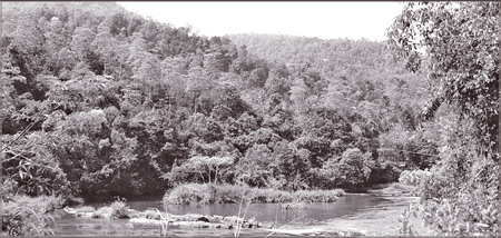 |
|
Kelani
river. Picture courtesy: Traveling Wess.com |
Indeed the whole of the Southern (Colombo) riverbank of the Kelani
river, from Crow Island as far as Kohilawatte is one long slum, with
houses squashed together amidst warehouses, factories and builders’
yards and the occasional large residence. The slums range from wooden
plank-built takaran -roofed shacks to three-storey-high narrow brick and
concrete shop-residences.
Artists and intellectuals
It is one of the saddest things about modern Colombo that the most
desirable residential properties are occupied by slum-lands and
shanty-towns of the utmost squalor, generally flood-prone and lacking in
basic sanitation.
A visit to any city in the developed Western countries will prove
that riverside properties are the most valued. Apart from residences,
river fronts provide open living space as well as urban landmarks, not
just for tourists, but for the residents.
This is particularly so among university-cities, where student life
is often woven around the waterway: Oxford has the Isis and Cambridge
has the Cam. Boston and Cambridge, Massachusetts abut the Charles River,
alongside which is the Charles River Reservation, which stretches
upriver from Boston Harbour for over 30 kilometres. Students from the
adjoining Massachusetts Institute of Technology, Boston University and
Harvard University use this park as a study place and as a place of
recreation, for eating out, cycling, adventure and just ‘hanging out’.
Recreational areas
The banks of Seine in Paris, with its stone quay walkways,
esplanades, and parks - historically, chosen haunts of artists and
intellectuals, as well as students - are popular places for recreation,
and are being re-connected by pedestrian walkways.
In London, the Thames waterfront was the main arena of activity for
centuries and the major tourist attractions spread along it. The Thames
River Walk, a pedestrian walkway on both sides of the river, provides 64
km of easy, level walking from Hampton Court to the East India Dock on
the north bank and the River Darent on the South bank. The lower reaches
of the Thames, earlier occupied by the London Docks are being
transformed, the bare warehouses, factories and empty docks becoming
financial, commercial, residential and recreational property.
The West India Docks became the site for the Canary Wharf business
district, Britain’s major financial centre after the City of London. The
London Docklands Light Railway was constructed to link the new
developments to the City of London.
For years Delhi virtually ignored the Yamuna, except as a repository
for urban waste. Now the Delhi Development Authority (DDA)is setting up
a riverbank walkway development, divided into core, transitional and
buffer zones, with wetlands as ‘counterpoints’ to the promenade.
The core zone will contain biodiversity parks, accessible to the
public only for educational purposes; the transitional zone will be
biodiversity rich layer where interaction between the people and nature
would be less controlled; and the transitional zone will contain parking
and recreational areas such as playgrounds, nursery and theme parks.
A similar plan should be adopted for the Kelani river bank in
Colombo, including the estuarine and sea frontage at Crow Island and
Mutwal. It should be kept in mind that, with global warming looming over
us, the water levels, marine, estuarine and river, will rise, inundating
low lying areas. Much of the Kelani river frontage is low-lying and
already subject to flooding. So the banks need to be built up to a
sufficient height to prevent future inundation.
Residential property
Public land could first be identified and the area could be zoned
into residential, commercial and recreational spaces. The existing slums
and shanties need to be demolished and the inhabitants re-housed in
liveable accommodation; these could be located further inland, in
redevelopments of the vast slum-lands of Colombo North and Colombo
Central, as well as in the adjoining Kolonnawa and Peliyagoda areas.
As in the Beira Lake and Diyawanna redevelopments, a promenade could
be constructed along the riverbank, within a ribbon of parkland and
recreational areas, punctuated by landings for boats. Owners of
warehouses and factories in the area could be encouraged to integrate
their properties into this development, converting them into
entertainment, shopping, restaurant, office and residential complexes.
The already existing educational institutions in the area could be
expanded into full-blown universities. Places of historical interest,
such as Whist Bungalow, could be brought back to their pristine glory
and the mini botanical garden recreated. The existing places of worship,
especially the Kovil complex on Whist Passage, could receive a facelift.
The beach at Crow Island could be cleaned up and once more become an
attraction for people rather than for garbage.
The hinterland would thus be converted into prime riverside
residential property, which would help to fund the development of the
area. Funding would also come from the additional revenues from tourism
both local and foreign, which would boost the area economically.
|


")

